
Geomative
  • Products
    • Resistivity and IP Tomography
    • Electromagnetic
    • Integrated Well Logging System
    • Airborne and Ground Magnetometers
    • Subsurface Environmental Monitoring System
    GD-12/22/32 1/6/12-Channel Resistivity IP Imaging System

    GD-12/22/32 1/6/12-Channel Resistivity IP Imaging System

    GD22 It integrates modules such as transmission, collection, control and power supply, and possesses capabilities of high-power transmission, high-precision signal collection, full waveform recording, IP induced polarization measurement, etc. Combined with professional acquisition APP and Geometa data platform, it is suitable for various scenarios of electrical exploration operations. It has a high protection level and strong environmental adaptability, and can meet the detection requirements in multiple fields such as geology, engineering and environment.

    GS-30 12-Channel Electric Receiving Station

    GS-30 12-Channel Electric Receiving Station

    GD-10 Electrical Resistivity & IP Imaging System

    GD-10 Electrical Resistivity & IP Imaging System

    The GD10 survey system adopts a modular and scalable hardware platform, enabling the collection of electrical survey data in various scenarios such as on the ground, in tunnels, and underwater. This system has brought a technological breakthrough to traditional engineering geophysical survey operations.

    GD-20 Multi-channel ERT/IP Imaging System

    GD-20 Multi-channel ERT/IP Imaging System

    The multi-channel collection method is more efficient and significantly reduces the construction cost.

    Laboratory Electrical Workstation

    Laboratory Electrical Workstation

    Multi-electrode resistivity imaging for versatile subsurface investigations.

    Learn more
  • DIGspace
    • DIGspace
    • Platform Fundamental Ability
    • Technical Methods
    • Applications
    • trial application & download
    DIGspace Platform

    DIGspace Platform

    Integrating geological, geophysical, and monitoring data into a unified subsurface cognition system. Deep analysis on desktop, collaboration on web.

    A 3D geospatial platform fusing multi-source survey data with surface spatial information — covering exploration analysis and long-term monitoring.

    Learn more
  • Solutions
    • Mineral Resource Exploration
    • Online Monitoring
    • Cross‑hole investigation
    • Hydrogeological Survey
    • Engineering Geology Investigation
    • Subsurface Environmental Monitoring
    Brazil Gold Ore Exploration Case

    Brazil Gold Ore Exploration Case

    Carry out geophysical exploration for sulfate zones with potential metal mineral resources in ESTADO DO PARÁ, Brazil, and locate metal ore deposits by electrical prospecting technology.

    Underground water and mineral exploration at Beishan Lead-Zinc Mine, Hechi, Guangxi

    Underground water and mineral exploration at Beishan Lead-Zinc Mine, Hechi, Guangxi

    Integrated geophysical solutions for mineral prospecting.

    Learn more
  • Support
  • About Us
中文Talk to an Expert
  • Products
  • DIGspace
  • Solutions
  • Support
  • About Us
Geomative

A provider of spatial intelligence technology and equipment, serving surveying, energy, transport and emergency response with fully self-developed hardware and software.

Products

  • Resistivity and IP Tomography
  • Electromagnetic
  • Integrated Well Logging System
  • Airborne and Ground Magnetometers
  • Subsurface Environmental Monitoring System

Industries

  • Mineral Resource Exploration
  • Online Monitoring
  • Cross‑hole investigation
  • Hydrogeological Survey
  • Engineering Geology Investigation
  • Subsurface Environmental Monitoring

Service & Support

  • Knowledge Base
  • FAQ
  • Document Downloads
  • Drivers & Software
  • Warranty Policy
  • Contact Support

copyright@2026 Geomative Co., Limited

Privacy PolicyTerms of UseSitemap
  1. Home
  2. Products
  3. Integrated Well Logging System
  4. Ground instruments

Ground instruments

Ground instruments
Combining over two decades of digital logging R&D experience with advanced international technology, a new-generation integrated CNC logging system built for domestic geological exploration scenarios.

Product Overview

Functions

The system can measure over twenty formation parameters and is widely used in metal minerals, coalfields, oilfields, radioactive minerals, hydrology and other exploration fields, with excellent performance.

Measurement Parameters

Power supply 220V 50Hz; operating environment temperature -20℃~45℃, humidity ≤90% (at 45℃); plotting depth scale 1:10~1:500; downhole instrument output signal bipolar encoding; computer communication port RS232/USB; downhole signal detection level ±0.5V~±12V; depth measurement range 0~9999.99m, depth resolution 0.28mm; speed measurement range 0~9999m/h; depth optical pulse signal 3600 pulses/meter.

Product Gallery
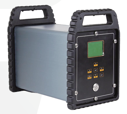
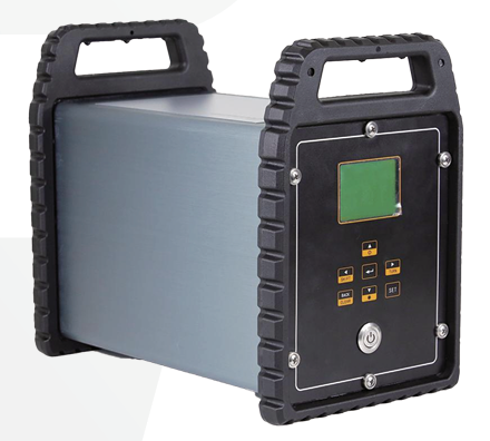
Front of Main Unit
Front of Main Unit
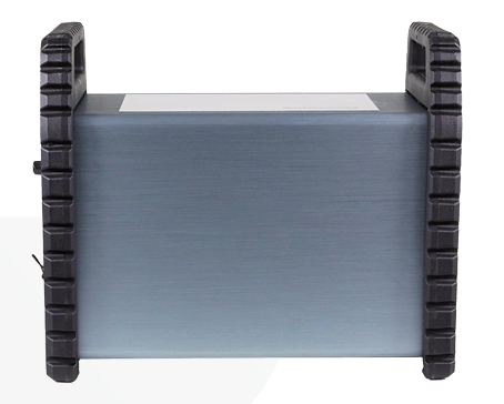
Rear of Main Unit
Rear of Main Unit
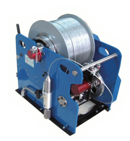
Winch
Winch

Ordering Information

GELS-Y
01
Innovation

1

02
Innovation

2

Technical Specifications

Parameters GELS-Y
Power Supply220V 50Hz
Operating Temperature-20℃~45℃
Operating Humidity≤90%(45℃)
Depth Range0~9999.99m
Depth Resolution0.28mm
Speed Range0~9999m/h
Depth Pulse3600 pulses/meter
Downhole SignalBipolar Encoding
Communication PortRS232 or USB
Detection Level±0.5V~±12V
Plotting Scale1:10, 1:20, 1:50, 1:100, 1:200, 1:500, etc.

Probes and Sondes

The resistivity logging probe is used to measure formation resistivity and obtain formation electrical parameters.

JDX-2Dr
JCX3-GMD
JWQ-1
JCX2-1

Ordering Information

Submodel 1Apparent Resistivity Logging ProbeGamma 3-Lateral Resistivity Logging ProbeMicrospherically Focused Logging ProbeDual Laterolog Probe
CodeJDX-2DrJCX3-GMDJWQ-1JCX2-1
Material Code————
Measurement ParametersGradient Resistivity, Potential Resistivity, Spontaneous Potential3-Lateral Resistivity, Natural Gamma, Spontaneous PotentialFlushed-Zone ResistivityDual Laterolog Resistivity
ApplicationFormation Permeability, Porosity, Water Quality, Formation Interface Interpretation———
Features—Focused Power Supply, Less Affected by Borehole Fluid / Surrounding RockElectrode-Array Focusing, High Measurement AccuracyFocused Current, Reducing Borehole-Fluid / Low-Resistivity Layer Influence

Induced polarization (IP) logging is an important method in borehole geophysical work for metal and non-metal minerals.

JJH-2

Ordering Information

Submodel 1Induced Polarization Loggingprobe
CodeJJH-2
Material Code—
Measurement ParametersSpontaneous Potential, Resistivity, Induced Polarization
ApplicationMetal/Non-metal Minerals, Hydrogeological Survey

Magnetic logging measures magnetic component anomalies inside the borehole via magnetic sensors.

JCC3-2A
JCH-2

Ordering Information

Submodel 1High-Precision 3-Component Magnetic Logging ProbeSusceptibility Logging Probe
CodeJCC3-2AJCH-2
Material Code——
Measurement Parameters3-Component MagneticMagnetic Susceptibility
ApplicationBorehole Magnetic Survey for Ore Prospecting—
Application—Auxiliary to Magnetic Survey, Rock/Ore Parameter Measurement

Acoustic logging measures the acoustic characteristics of rock formations along the borehole section, i.e., the propagation and attenuation laws of ultrasound in rock.

JSS-2

Ordering Information

Submodel 1Acoustic Logging Probe
CodeJSS-2
Material Code—
Measurement ParametersAcoustic Velocity, Acoustic Attenuation
ApplicationLithology Analysis, Porosity Estimation

Density logging is a nuclear logging method based on the Compton scattering effect.

JMD-1
JMZD-2D

Ordering Information

Submodel 1Density Logging ProbeDensity Combination Logging Probe
CodeJMD-1JMZD-2D
Material Code——
Measurement ParametersFormation DensityDensity, Resistivity, Spontaneous Potential, Caliper, Natural Gamma
Gamma SourceCs-137 (0.661MeV)—
Application—Oil/Coal/Gas Exploration

Gamma logging measures the total natural gamma ray count, used for formation division and lithology identification.

JFS-2
JZN-1

Ordering Information

Submodel 1Single-Channel Radioactive Magnetic-Locating Logging ProbeNatural Gamma Spectrometry Logging Probe
CodeJFS-2JZN-1
Material Code——
Measurement ParametersNatural Gamma, Magnetic LocatingGamma Spectrometry (U/Th/K)
DetectorNaI + Photomultiplier Tube—
Application—Radionuclide Identification, Lithology Analysis

Borehole temperature logging is used to measure fluid temperature variation inside the borehole.

JWY-1
JWTX-1

Ordering Information

Submodel 1Borehole-Temperature & Fluid-Resistivity Logging ProbeTemperature & Deviation Logging Probe
CodeJWY-1JWTX-1
Material Code——
Measurement ParametersBorehole Temp, Fluid ResistivityBorehole Temp, Temp Gradient, Inclination, Azimuth
ApplicationHydrogeology, Aquifer IdentificationSubsurface Fluid, Geothermal Research

Flow logging is used for fluid flow velocity measurement in boreholes in hydrogeology, geology, coalfield, oil and other industries.

JDL-2W

Ordering Information

Submodel 1Flow & Water-Level Logging Probe
CodeJDL-2W
Material Code—
Measurement ParametersFlow Velocity, Flow Direction, Water Level
ApplicationHydrogeology/Geology/Coalfield/Oil

Caliper logging measures the borehole diameter by mechanical-arm contact.

JJY-3D
JJY-2D

Ordering Information

Submodel 13-Arm Caliper Logging ProbeX-Y Dual Caliper Logging Probe
CodeJJY-3DJJY-2D
Material Code——
Measurement ParametersCaliper (3-Arm)Caliper (X-Y Dual Direction)
FeaturesDynamic Seal Piston, Zero-Temp-Drift Sensor4-Arm Contact, Zero Temp Drift

The deviation probe is used to measure the inclination angle and azimuth of the borehole.

JJX-3019
JTL-3019

Ordering Information

Submodel 1Combination Deviated ProbeFiber-Optic Gyro Deviation Probe
CodeJJX-3019JTL-3019
Material Code——
Measurement ParametersNatural Gamma, Inclination, AzimuthInclination, Azimuth (True North)
FeaturesDigital Logger, Real-time DisplayFiber-Optic Gyro, Long Life, No Surface Calibration Required

Cementing quality multi-parameter combination logging can simultaneously measure multiple parameters in a single run.

JMTC

Ordering Information

Submodel 1Cementing Quality Multi-Parameter Combination Logging Probe
CodeJMTC
Material Code—
Measurement ParametersCasing Cementation Damping, Borehole Temp, Inclination, Azimuth, Natural Gamma, Monopole Current
FeaturesMulti-parameter Combination, High Efficiency

Neutron logging is a nuclear logging method.

JZZ-1

Ordering Information

Submodel 1(Controllable Source) Compensated Neutron Logging Probe
CodeJZZ-1
Material Code—
Measurement ParametersNeutron Porosity
Neutron SourcePlutonium Isotope (Optional Controllable Source)

The multi-parameter combination logging probe integrates multiple measurement functions.

JSXW-3019

Ordering Information

Submodel 1Multi-Parameter Combination Logging Probe
CodeJSXW-3019
Material Code—
Measurement ParametersCaliper, Natural Gamma, Fluid Level
FeaturesMulti-parameter integration, high efficiency

The formation mineralization logging probe can simultaneously provide two conductivity logs, corresponding to formation conductivity curves within the 'middle' and 'deep' radial ranges of the borehole. In permeable formations, after borehole fluid replaces the in-situ formation fluid, an invaded zone with different electrical parameters is formed, making formation mineralization logging particularly effective. The probe has high stability and an extremely wide dynamic range, enabling accurate conductivity measurement in sandy-clay layers and highly mineralized sandy formations. Unlike other resistivity probes, the induction logging probe can be used in dry holes and non-metallic casing wells.

JKH-1

Ordering Information

Submodel 1Formation Mineralization Logging Probe
CodeJKH-1
Material Code—
Measurement ParametersProvides Two Conductivity Logs
FeaturesMCU automatically compensates according to temperature changes.

Litho-density logging is an improvement and extension of density logging. In addition to recording rock density, it also measures the formation photoelectric absorption cross-section index Pe, which is related to lithology. During logging, the downhole instrument separately records the higher-energy and lower-energy parts of the scattered gamma rays. The scattered gamma ray intensity in the higher-energy part depends on density; the lower-energy part is mainly related to lithology and also to density; after processing, Pe can be obtained.

Ordering Information

Submodel 1Litho-Density Logging Probe
CodeNone
Material Code—
Measurement ParametersDensity, Photoelectric Absorption Cross-Section Index Pe of Formation
FeaturesUses long- and short-spacing detectors measured simultaneously to compensate for adverse factors such as mud cake

The fluid sampler is a probe with an electric valve installed on its chamber. Before the probe is placed into the borehole, the valve remains normally closed; the winch lowers the probe to the specified depth, the computer activates the electric valve on the probe via software, and after the chamber is filled with fluid, the electric valve on the probe is activated again via software to keep it normally closed, then the probe is retrieved and the manual valve at the bottom is used to pour out the sample

JQY-1

Ordering Information

Submodel 1Fluid Sampling Probe
CodeJQY-1
Material Code—
Measurement Parameters—
FeaturesHigh-torque motor drives a ball screw

The water quality detection probe combines multi-parameter sensors, equipped with 6 sensors to measure: pressure, temperature, conductivity, dissolved oxygen, pH and redox potential. The probe is specially designed for groundwater and environmental geological surveys; it uses reliable, accurate, drift-free high-quality sensors to record a continuous profile of fluid properties inside the borehole.

JSQ-1

Ordering Information

Submodel 1Water Quality Detection Probe
CodeJSQ-1
Material Code—
Measurement ParametersContinuous profile of fluid properties inside the borehole
FeaturesOn-site acquisition greatly reduces the need for water samples and avoids data anomalies caused by secondary pollution

The geothermal gamma combination logger combines pressure, borehole temperature, temperature gradient and natural gamma measurement parameters into one, improving logging efficiency. It adopts a cableless logging measurement method; field logging equipment is lightweight and simple to operate. The digital geothermal logger is designed for a maximum temperature of 250℃/6 hours and a maximum pressure resistance of 100MPa, suitable for high-temperature deep holes.

JFSW-H(W)

Ordering Information

Submodel 1Geothermal Gamma Combination Logging Probe
CodeJFSW-H(W)
Material Code—
Measurement ParametersNatural Gamma
FeaturesUses a platinum resistance sensor Pt-1000, featuring high temperature measurement accuracy and good stability.

The geothermal resistivity deviation probe is a multi-purpose, high-efficiency combination logger. One run can simultaneously measure borehole temperature, inclination, azimuth, lateral resistivity and other parameters. Resistivity measurement adopts focused current, reducing the influence of borehole fluid and low-resistivity layers on calculated resistivity, making the measured apparent resistivity closer to the true formation resistivity. Through the measured inclination and azimuth, parameters such as borehole curvature eccentricity, horizontal displacement, and vertical distance can also be calculated.

JWDX-H(W)

Ordering Information

Submodel 1Geothermal Resistivity Deviated Probe
CodeJWDX-H(W)
Material Code—
Measurement ParametersInclination, Azimuth, borehole curvature eccentricity, horizontal displacement, vertical distance.
FeaturesMulti-parameter integration, high efficiency

The GELS-WCH series logging cable winch is dedicated equipment for geophysical exploration and geological survey. It is mainly used with integrated digital logging equipment, and can also be used with other logging equipment. The GELS-WCH series winches are mostly magnetically shielded design, with stepless speed regulation and automatic cable arrangement. Their performance is suitable for various geological exploration fields. They can be used in plateau (altitude ≤5500 m), land, offshore and other environments for geophysical exploration and geological survey work.

The GELS-WCH3 winch controller is mainly used to control the speed and direction of the electric winch, and to display the depth and speed of the cable.

GELS-WCH

Ordering Information

Submodel 1Winch
CodeGELS-WCH
Material Code—
Measurement ParametersDisplays cable depth and speed.
FeaturesUsable in plateau (altitude ≤5500 m), land, offshore and other environments