


The slope in and around the Project Area is generally flat with an average elevation of 200m above mean sea level. The area is mostly planted with pineapple, corn and cassava.
The area is bounded by two rivers, Cagayan de Oro River to the north and west, and Tumalaong River to the east.
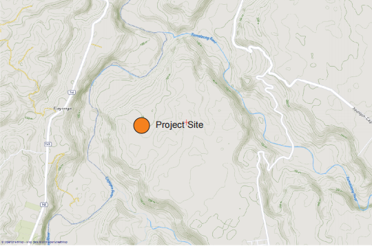
Baungon is generally underlain by Pliocene to Quaternary deposits as a result of volcanic activities in the past. These volcanic materials may have originated from active and inactive volcanic belt from Camiguin volcanic complex down south to Mt. Parker in South Cotabato. Recharge of groundwater to the Cagayan de Oro Water District wells located along the Cagayan de Oro River banks are said to have originated from these pyroclastic deposits. Fig. 5 gives the geology of Baungon area.
Fig. 5. Geology of Baungon, Bukidnon

Adapted from Draft Master Plan Final Report - Formulation of an Integrated River Basin Management and Development Master Plan, Cagayan de Oro River Basin. The Project Site is located in red circle.
The projected daily water requirement for the Project is about 50,000 Liters per day, equivalent to 0.58 liters/sec or 2.08 cubic meters/hour. This figure is for the broilers, farm personnel and general water consumption.
The per capita water requirement figures can be used to determine how much total water requirement daily is needed for the project. By multiplying these figures according to the number of chicken, personnel and other usage, total daily water requirement can be determined. Actual water requirement was furnished by PhilFresh.
Water is available in the area. However, because the quantity of water present in the area is not yet certain, this groundwater investigation was conducted.
Table 2. Daily Water Requirement
Daily Water Requirement of PhilFresh Meats Broiler Project

1.Supply
1 Groundwater Well Well drilling may be considered as primary water supply source for the project. Since there is no water well drilled in the area and the vicinity of the Project Area, no reference can be established as to whether there is groundwater source in the area or not, and if there is, how much will be the discharge rate.
To answer the above question, seven (7) vertical electrical soundings, or georesistivity (apparent resistivity), were measured within the Project Area as shown in Figure 6. The results of the VES survey were given in Annex 1.
After the georesistivity survey, the raw field data were analyzed and interpreted utilizing a software specifically for the interpretation of the georesistivity field data.
We are looking at low resistivity values from about 10 to 100 ohm.m where water-bearing formation may be drilled to extract groundwater. However, the true discharge rate or flow rate of the well can only be determined after drilling and pump testing of the well.
From the interpretation, the true resistivity and thickness of the various lithologic (rock formation) in the area were estimated, and this are given in Annex 2.
There are two potential water well drill sites identified in the area and this are shown in Figure 7. The first recommended site is where the VES PFM-1 is located. PFM-1 indicates a low resistivity of 7.31 to 69.6 ohm.m, from 5.7m to 120m or an equivalent thickness of 114.43m. The other recommended site is where VES PFM-3 is located. PFM-3 has an indicated low resistivity value of 22.9 ohm.m at a depth from 23.3m up to infinity, meaning the thickness of this potential water-bearing formation may extend below 120m.
There are two more sites with low resistivity values but of lesser thickness than the other two recommended sites. These are PFM-2 with 27m thickness at depth from 50m to 77m, and PFM-6 with 25m thickness at depth from 7m to 32m. These two locations may be drilled as emergency source in the event sites 1 and 2 will encounter future problem like shutdown for maintenance, etc.
Fig. 6 Project Area Showing VES Point

Fig. 7 Recommended Sites for Drilling

2 Rivers
The Project Site is bounded by two rivers which are the Cagayan de Oro River and the Tumalaong River. If these rivers will be considered there will be a very big problem on right of way issue plus the fact that the quality of river water is questionable for use as source for the broiler project. These sources will not be considered for this present study.
3 Rainwater
The Project area is blessed with a steady rainfall all throughout the year. Although there is rain in all months of the year, there will be times when there is no rain in several days (see Figure 3). If rainwater will be considered as a source for drinking water for the stocks, provision for sufficient storage coupled with pumping if the storage will be located at ground or underground level, should be planned ahead.
The amount of rainfall for Baungon (this applies to the Project area) is given in Table 1, Section 4.0.
As a guide for the utilization of rainwater as an alternative source for broiler stock drinking water, Table 3 will guide the proponent in planning for the roof catchment and sizing of storage.
From Table 2 in Section 7.1, let us maximize the water requirement by assuming that the per capita requirement for each mature broiler chicken is 100mL/day. The washing/utilities and farm personnel requirement 1,200 Liters per day.
Daily Water Requirement : 50,000 L/day Provision for storage : 50,000 Liters of Storage
Table 3. Amount of Daily Rainfall and Area of Roof Catchment for 50,000 L/day

To determine the area of roof catchment needed to capture and store 50,000 Liters of rain daily, assuming that this figure will be stored 100%, then from Table 3, refer to the smallest daily rainfall occurrence and use this as reference to size the roof catchment area. Since the month of March/April has the smallest rainfall occurrence, for conservative estimate, we will use this as reference in sizing the roof catchment; in the event when the rain becomes more pronounced then the 50,000 Liters storage will be filled much faster.
Therefore we need to provide at least 108,000 square meters of roof surface to capture the rainfall in 24 hours that can be stored for consumption.
The advantage of utilizing rainwater is that it is fresh and very little treatment is necessary to make it suitable for any intended purpose. And most of all it is available anywhere where it is needed. Just provide the roof catchment and the storage/pumping facilities, and the water is there.
There are two recommended sites for well drilling in the area, site 1 (PFM- 1) which can drilled to 120m and site 2 which can be drilled to 120m and deeper. Additionally two sites have the potentially for shallow well drilling although the potential aquifer that can be tapped is less than 30m.
The quality of water in the area is fresh owing to its elevated location at 200m above sea level average.
River sources are quite far from the project and there may be problems on right of way even if this source will be considered. From verbal accounts springs were flowing in the area but now are long gone.
Rainwater is also a potential source of water for the project but there should be provision for enough storage to store the desired volume of rainwater.
The total water requirement for the project is 50,000L/day which is equivalent to 0.58 liters/sec or 2.08 cubic meters/hour. Therefore a well which can yield 1 L/sec or 3.6 cubic meters/hour will be more than enough for the project.


Industry-leading geophysical equipments and service provider supplier


