1.To describe the characteristics and distribution of site pollution through environmental geophysical methods, and to provide the basis for sampling survey and well setting depth
2.To verify the effectiveness of geophysical methods for multi organic pollution detection.

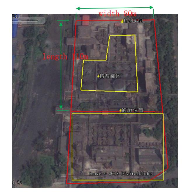
1.Because most of the planned area has tank base structure, and there are steel plates and reinforced concrete structures on the site, it is impossible to lay electrodes on the site. Therefore, the detection is conducted in the excavated area next to the planned area, and the wiring area is also within the scope of the original refined benzene workshop.
2. At present, 0-5m of the area is mainly backfill, building structure, construction waste and a small amount of sand silt, the surface is partially covered with cement, the pollutants are mainly polycyclic aromatic benzene series, and there are NAPL in some parts. The pebble layer below 5m is mixed with a small amount of Chinese and Western Sands. The main pollution medium is soil gas and benzene series naphthalene pollution. The groundwater is about 50 meters underground.
3. As can be seen from the existing excavation on site, there are a lot of pebbles and construction waste in the backfill.
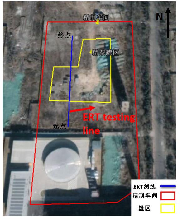
Due to the limitation of site conditions, only one electrical resistivity tomography survey line has been set up in the constructed section this time.
The pole distribution of high density resistance measuring line is as follows (blue in the right figure):
Line length: 100M
Electrode spacing: 1m
Device type: wenth and gradient arrangement

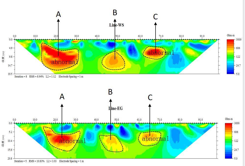
It can be seen from the detection sections of wenss method and gradient method that the two permutations show that three areas with relatively high resistivity are a, B and C, and the three abnormal boundaries are closed and distributed in a cluster shape, in which the apparent resistivity of a and C is greater than 2000 ohm meters, and the average depth of the abnormal is 4.5-14.7 meters; The abnormal resistivity at position B is about 450 ohm M. based on the outcrop test results, it is speculated that the abnormality at position B may be caused by large particle materials and non pollution; the two abnormalities at position a and C may be caused by pollution, so it is recommended to take samples here for verification.

1. Two kinds of devices are used in this investigation, and two abnormal areas are found. It is preliminarily speculated that they may be caused by pollution, but more physical property data and abnormal drilling verification are required.
2. Due to the limitation of the site, only one high-density resistivity survey line was detected to verify the effectiveness of the method.
3. The high-density resistivity method is effective in the investigation of serious organic pollution of underground soil, which can help to determine the underground pollution halo, and further expand the scope of investigation to delineate the spatial distribution of underground pollutants.
4. The advantage of non-invasive geophysical exploration technology to assist soil and groundwater pollution investigation lies in the limitation of pollution potential or analysis of hydrogeological conditions. In addition to the fact that the detection process has almost no impact on the environment, its greatest advantage lies in the large exploration range (including horizontal and depth range), fast speed, high reliability, and more intensive exploration.