
Geomative
  • Products
    • Resistivity and IP Tomography
    • Electromagnetic
    • Integrated Well Logging System
    • Airborne and Ground Magnetometers
    • Subsurface Environmental Monitoring System
    GD-12/22/32 1/6/12-Channel Resistivity IP Imaging System

    GD-12/22/32 1/6/12-Channel Resistivity IP Imaging System

    GD22 It integrates modules such as transmission, collection, control and power supply, and possesses capabilities of high-power transmission, high-precision signal collection, full waveform recording, IP induced polarization measurement, etc. Combined with professional acquisition APP and Geometa data platform, it is suitable for various scenarios of electrical exploration operations. It has a high protection level and strong environmental adaptability, and can meet the detection requirements in multiple fields such as geology, engineering and environment.

    GS-30 12-Channel Electric Receiving Station

    GS-30 12-Channel Electric Receiving Station

    GD-10 Electrical Resistivity & IP Imaging System

    GD-10 Electrical Resistivity & IP Imaging System

    The GD10 survey system adopts a modular and scalable hardware platform, enabling the collection of electrical survey data in various scenarios such as on the ground, in tunnels, and underwater. This system has brought a technological breakthrough to traditional engineering geophysical survey operations.

    GD-20 Multi-channel ERT/IP Imaging System

    GD-20 Multi-channel ERT/IP Imaging System

    The multi-channel collection method is more efficient and significantly reduces the construction cost.

    Laboratory Electrical Workstation

    Laboratory Electrical Workstation

    Multi-electrode resistivity imaging for versatile subsurface investigations.

    Learn more
  • DIGspace
    • DIGspace
    • Platform Fundamental Ability
    • Technical Methods
    • Applications
    • trial application & download
    DIGspace Platform

    DIGspace Platform

    Integrating geological, geophysical, and monitoring data into a unified subsurface cognition system. Deep analysis on desktop, collaboration on web.

    A 3D geospatial platform fusing multi-source survey data with surface spatial information — covering exploration analysis and long-term monitoring.

    Learn more
  • Solutions
    • Mineral Resource Exploration
    • Online Monitoring
    • Cross‑hole investigation
    • Hydrogeological Survey
    • Engineering Geology Investigation
    • Subsurface Environmental Monitoring
    Brazil Gold Ore Exploration Case

    Brazil Gold Ore Exploration Case

    Carry out geophysical exploration for sulfate zones with potential metal mineral resources in ESTADO DO PARÁ, Brazil, and locate metal ore deposits by electrical prospecting technology.

    Underground water and mineral exploration at Beishan Lead-Zinc Mine, Hechi, Guangxi

    Underground water and mineral exploration at Beishan Lead-Zinc Mine, Hechi, Guangxi

    Integrated geophysical solutions for mineral prospecting.

    Learn more
  • Support
  • About Us
中文Talk to an Expert
  • Products
  • DIGspace
  • Solutions
  • Support
  • About Us
Geomative

A provider of spatial intelligence technology and equipment, serving surveying, energy, transport and emergency response with fully self-developed hardware and software.

Products

  • Resistivity and IP Tomography
  • Electromagnetic
  • Integrated Well Logging System
  • Airborne and Ground Magnetometers
  • Subsurface Environmental Monitoring System

Industries

  • Mineral Resource Exploration
  • Online Monitoring
  • Cross‑hole investigation
  • Hydrogeological Survey
  • Engineering Geology Investigation
  • Subsurface Environmental Monitoring

Service & Support

  • Knowledge Base
  • FAQ
  • Document Downloads
  • Drivers & Software
  • Warranty Policy
  • Contact Support

copyright@2026 Geomative Co., Limited

Privacy PolicyTerms of UseSitemap
  1. Home
  2. Products
  3. Electromagnetic
  4. Geopro-10 Ground Penetration Radar

Geopro-10 Ground Penetration Radar

Geopro-10 Ground Penetration Radar
Ground Penetrating Radar (GPR) performs non-destructive underground detection through electromagnetic pulse reflection, covering both 2D and 3D array products, with a wide antenna frequency range and balanced shallow and deep detection, widely used for pipelines, engineering inspection and geological archaeology.

Product Overview

Functions

The system supports three acquisition modes: distance / time / point measurement; provides various center-frequency antennas of 35/70/100/200/400/900/1500/1600/2000MHz; features on-site processing functions such as real-time zero-offset calibration, FIR/IIR filtering, inter-trace averaging, background removal and data stacking; supports GPS positioning and coordinate-associated saving; equipped with GeoProProjecto post-processing software and DIGspace cloud display, realizing an integrated workflow of data acquisition, processing, interpretation and sharing.

Measurement Parameters

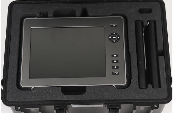
Geopro-10 host: 10.4-inch 1024×768 LED display, built-in 128G storage, 11.1V lithium battery (up to 3 hours on full charge), IP65 protection; sampling points selectable from 256 to 8192, time window 10~1500ns, scan speed 32~512 traces/sec.

Product Catalog

Ordering Information

Geopro-10 2D Portable Radar

Application Cases

Mineral Resource Exploration

Mineral Resource Exploration

Online Monitoring

Online Monitoring

Cross‑hole investigation

Cross‑hole investigation

Hydrogeological Survey

Hydrogeological Survey

Engineering Geology Investigation

Engineering Geology Investigation

Subsurface Environmental Monitoring

Subsurface Environmental Monitoring

View more

Key Selling Points

01
Innovation

1

02
Innovation

2

Technical Specifications

ParameterGeopro-10
System Type2D portable GPR
ChannelsSingle channel (per antenna)
Antenna Frequency Range35~2000MHz (interchangeable)
Number of Sampling Points256/512/1024/2048/4096/8192
Time Window Range10~1500ns
Max Scan Speed512 traces/sec
Scan WidthSingle trace
Typical Detection Depth0.3~40 m (depends on frequency)
Positioning MethodGPS (RS232, GPGGA)
Display / Storage10.4" LCD / 128G memory
Protection RatingIP65
Power Supply11.1V lithium battery, approx. 3 hours
Total WeightHost approx. 2kg (excluding battery)
Operating Temperature-10℃~+50℃

Accessories and Attachments

The Geopro-10 series GPR antennas cover the full 35~2500MHz frequency band, divided by coupling method into three types: ground-coupled, air-coupled and unshielded, suitable for different detection depths and scenarios. The low-frequency band (35~100MHz) is suitable for geological survey, water conservancy engineering and deep mineral exploration; the mid-frequency band (200~400MHz) is suitable for tunnel lining, pavement structure and urban pipeline detection; the high-frequency band (900~2500MHz) is suitable for fine inspection of concrete structures, bridges and pavement surfaces. GER-10/GER-40 hosts are compatible with the full antenna series and support automatic identification and parameter configuration.
Specification: Center frequency 35~2500MHz, covering 0.1~40m detection depth

Coupling method: Ground-coupled / Air-coupled / Unshielded (three types)

Protection rating: IP65 (outdoor waterproof and dustproof)

Ordering Information

Item CodeModelProduct NameCenter FrequencyDetection DepthCouplingWeightLengthCompatible Device
M4.0001GeoPro T50Radar Antenna————50 MHz AntennaGeopro-10
M4.0002GeoPro T100Radar Antenna————100 MHz AntennaGeopro-10
M4.0003GeoPro T200Radar Antenna————200 MHz AntennaGeopro-10
M4.0004GeoPro T400Radar Antenna————400 MHz AntennaGeopro-10
M4.0005GeoPro T900Radar Antenna————900 MHz AntennaGeopro-10
M4.0006GeoPro T1600Radar Antenna————1600 MHz AntennaGeopro-10
M4.0007GeoPro T2500Radar Antenna————2500 MHz AntennaGeopro-10
—GER35AGER35A Unshielded Antenna35MHz1~40mUnshielded / Ground-coupled6.9kg—Geopro-10
—GER100AGER100A Ground-Coupled Antenna100MHz1~30mGround-coupled13.6kg—Geopro-10
—GER200AGER200A Ground-Coupled Antenna200MHz1~6mGround-coupled——Geopro-10
—GER400AGER400A Ground-Coupled Antenna400MHz1~4mGround-coupled3.6kg—Geopro-10
—GER900AGER900A Ground-Coupled Antenna900MHz0.5~1.5mGround-coupled2.3kg—Geopro-10
—GER1600AGER1600A Ground-Coupled Antenna1600MHz0.2~0.5mGround-coupled1.3kg—Geopro-10
—GER1500AGER1500A Air-Coupled Antenna1500MHz0.2~0.7mAir-coupled4.6kg—Geopro-10
—GER2000AGER2000A Air-Coupled Antenna2000MHz0.1~0.5mAir-coupled4.6kg—Geopro-10
—GER2500AGER2500A Ground-Coupled Antenna2500MHz0.1~0.3mGround-coupled1.3kg—Geopro-10

The odometer wheel is an essential accessory for Geopro-10 distance-mode acquisition, consisting of a wheel body with integer circumference and a photoelectric encoder, used to accurately record the antenna movement distance and trigger equidistant acquisition. When a worn or replaced vehicle wheel is used as the odometer wheel, it can be calibrated via the host calibration function; supports marker inversion to fit left/right wheel installation.

Specification: Photoelectric encoder odometer wheel, circumference 300/450mm, 500 pulses/rev

Material: Aluminum alloy wheel body + rubber outer ring

Protection rating: IP54

Features: Calibratable after wear, supports marker inversion (left/right wheel installation)

Ordering Information

Material CodeModelProduct NameCircumferencePulse CountMatching AntennaApplication Scenario
M6.1001W300W300 Odometer Wheel300mm500900MHz AntennaMid-high frequency shallow detection
M6.1002W450W450 Odometer Wheel450mm500100/200/400MHz AntennaMid-low frequency deep detection

Used for transmission of radar control signals and echo signals between the Geopro-10 host and the antenna, adopting an 8-core aviation plug and shielded twisted-pair structure to ensure stable digital signal transmission and strong anti-interference capability. Standard length 2m, optional 5m extended type for vehicle operation.

Specification: 8-core aviation plug main control cable, male connector to host / female connector to antenna

Material: Gold-plated contacts + shielded twisted pair

Protection rating: IP65

Length: Standard 2m / optional 5m

Ordering Information

Material CodeModelProduct NameSpec LengthConnector TypeTransmission FunctionApplication Scenario
M1.4001MC-2MMain control cable (2m)2m8-core aviation plugRadar control and echo signal transmissionClose-range connection between host and antenna
M1.4002MC-5MMain control cable (5m)5m8-core aviation plugRadar control and echo signal transmissionVehicle / long-distance operation

The Geopro-10 host uses an NL2024 type 11.1V lithium-ion battery; a single fully charged unit can work for about 3 hours. The LHJ1001 dual-slot smart charger supports mixed charging of lithium and NiMH batteries, with over-voltage, over-current, short-circuit, timeout and high-temperature protection, and supports calibration and activation of damaged batteries. It is recommended to equip at least 2 spare batteries for field operations to ensure all-weather operation.
Specification: 11.1V lithium-ion battery pack + dual-slot smart charger

Material: Lithium battery + smart protection circuit

Protection rating: IP54

Endurance: A single full charge works about 3 hours; charging time 2.5~3 hours

Ordering Information

Material CodeModelProduct NameRated CapacityOutput VoltageEnduranceApplication Scenario
M7.4001NL2024NL2024 Spare Lithium Battery73Wh11.1VApprox. 3 hoursGER-10 range extension
M7.4002LHJ1001LHJ1001 Dual-slot ChargerDual-slot 2AAC 220VFully charged in 2.5~3 hoursField camp recharging