
Entrusted by the owner, Geomative surveyed a storage yard in a mining area, by using high-density resistivity method (ERT) as the main detection method, to found out the development of unfavorable geological developments such as the fissures and broken zones below the surface water gushing point in the field, to analyze the causes of water inflow, discover hidden aqueduct channels, and describe the current situation of underground strata with specific images of geophysical exploration results, so as to accurately find out the location and spatial distribution of cracks or broken zones.
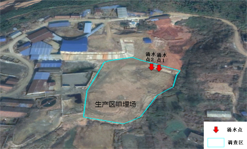
According to the site survey and determination, with the surface water gushing point as the center point, a divergent survey line is laid out, and the information of the underground structure around the water gushing point can be detected. The specific survey line layout is as shown in the figure below. There are a total of 5 survey lines, each of which exceeds 200 meters.
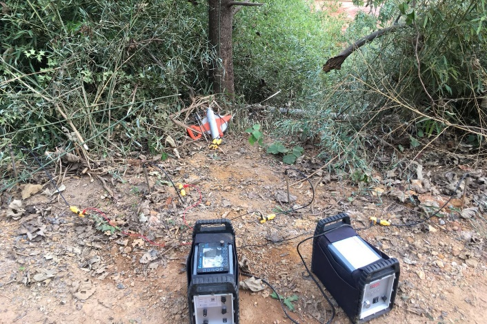
Figure 3 Survey line layout and field work diagram
In this survey, the GD-20 was used for high-density resistivity measurement, and the measurement point information was collected by RTK.
GD-20 high-density resistivity system is a world-leading multi-functional DC electrical method instrument developed by our company with the latest digital and analog circuit technology. It supports conventional 1D VES method, and can also use 2D and 3D arrays for cross-section mapping and can be used for SP, apparent resistivity and IP testing.
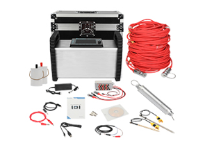
Figure 2 GD-20 high density resistivity system diagram
The high-density resistivity method has the advantages of high resolution, high accuracy and deep detection depth. It is suitable for detecting various unfavorable geological bodies, soil and groundwater pollution problems and hydrogeological distribution. The processed electrical stratigraphic map can completely present the underground environmental characteristics.
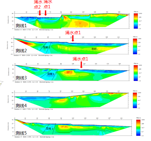
Figure 4 Results of high-density resistivity method
In order to see the development state of the cracks in the survey area more intuitively, the resistivity results are composed into a slice map to obtain the comprehensive high-density resistivity distribution result map of the survey area, and show the slicing results from different angles.
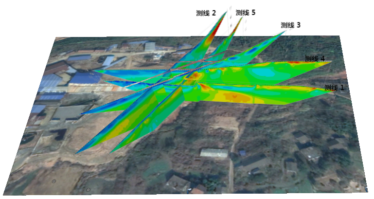
Figure 5 Slice diagram of line 1-5
in conclusion
1. According to the results of the high-density resistivity method, it can be seen that there are no cracks or broken zones in the field. There are cracks about 45 meters north of the surface water inflow point in the field. The development direction of the cracks is roughly in the east-west direction and the width is about 10 meters, leaning north.
2. Since there are no fissures or broken zones in the field, it is speculated that the reason for the surface water gushing point is that the upstream fissure zone and the surface are connected to form water conduction, and there is a hidden connection channel from the fissure zone to the surface water gushing point in the field, through which groundwater passes. The fissure converges downstream and gushes out at the gushing point.
3. The high-density resistivity method is a practical, efficient and non-destructive method, which can be used to detect bad geological bodies well, to find out surrounding structures, fissures and other geological conditions, and to find hidden leakage channels.