In accordance with the "Technical Guidelines for Site Environmental Investigation" (HJ25.1-2014), a comprehensive site investigation was conducted to assess potential contamination within a specific landfill site. Our company was commissioned to investigate the presence and extent of solid waste deposits within the site, focusing on delineating their boundaries and calculating the volume of buried waste.
The buried solid waste consists of foreign materials that exhibit significant electrical resistivity differences compared to the native soil. By utilizing Electrical Resistivity Tomography (ERT) technology and strategically placing multiple ERT survey lines, we analyzed the resistivity contrasts between the landfill and unaffected areas. This approach allowed us to accurately determine the boundaries and extent of the waste deposits.

High-Resolution Geophysical Techniques:
Deployed Geomative’s precision ERT equipment to delineate the interface between the landfill materials and the native geological strata.
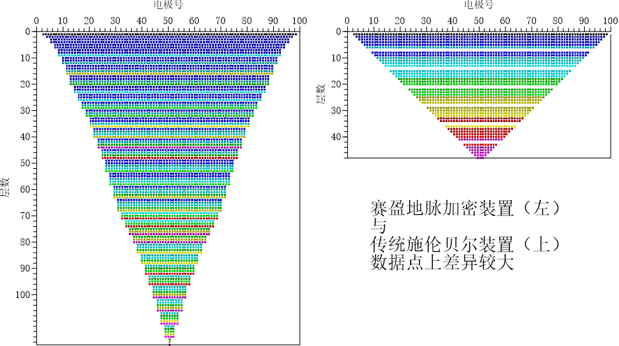
Utilized specialized landfill detection systems to acquire data on the depth and lateral extent of the waste deposits.
3D Data Processing and Visualization:
Processed the collected geophysical data using advanced 3D modeling software.
Generated visualizations to clearly depict the spatial distribution and depth of the buried waste.
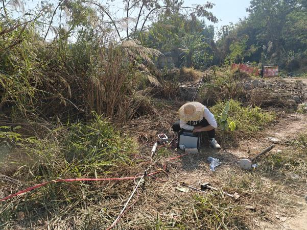
On-site Geophysical Surveys: Conducted detailed field measurements, including electrode deployment and RTK (Real-Time Kinematic) coordinate acquisition, ensuring data accuracy.
Instrumentation and Data Handling: Operated resistivity meters and data acquisition systems with precision to collect reliable subsurface information.

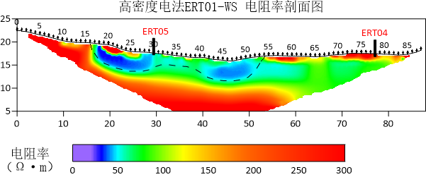
2D Profile Analysis:
The ERT inversion results indicated that the foreign waste material exhibits lower resistivity compared to the native soil. This distinct contrast allowed us to clearly delineate the extent and depth of the buried waste, providing critical information for future remediation efforts.

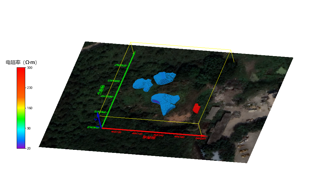
3D Model Insights:
The 3D model revealed a comprehensive view of the spatial distribution of buried waste.
Identified a zone with exposed waste in the southeastern corner, characterized by higher resistivity. Further spatial interpolation (Inverse Distance Weighting) of geophysical data enabled precise volume calculations of the buried waste.
